IIT Kanpur
Focused on programming and geoinformatics learning
M.Tech. Thesis
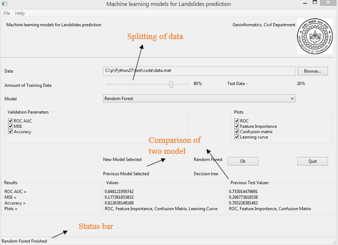
Spatial prediction for landslides using machine learning models
1) Compare machine learning models with validation statistics in Python (Decision tree, Random forest, Logical regression,
SVM and ANN) for spatial prediction of an event in wide area like landslides in Nainital, India.
2) Understand why conventional predictors fail to produce
satisfactory results.
3) Investigations have revealed that major factors affecting landslide risk prediction include slope,
aspect, NDVI value and distance from road, river and other landslides.
4) Random forest and SVM learning method give satisfactory result.
Research Projects
Target Detection with Hyperspectral Imagery
Learn analysis and application of sub-pixel target detection algorithms in hyperspectral imaging data from Hyperion sensors of Delhi (Man- Made) and Himalayan region (Natural) using spectral information of the materials.
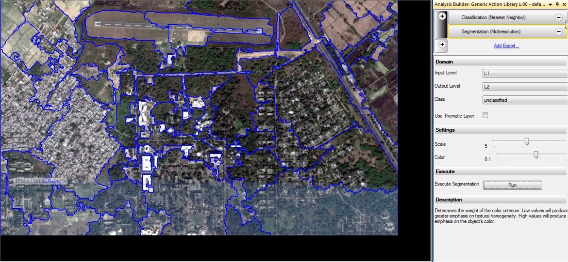
Object-based image analysis of image data
Discussed several drawbacks of prevailing per-pixel methods when applied to remote sensing data and OBIA is used to analyse IIT Kanpur Image data.
CSIRO's Zebedee technology on GPS less laser scanning
Demonstrated development, analysis, and application of Zebedee technology of 3D laser scanning. Drawback and future scope of these technologies are highlighted using case study (police mapping and cultural heritage).
Study of celestial objects with radio astronomy
Described radio astronomy with Astro-informatics by going through various discoveries. Overviewed radio fundamentals, history of radio astronomy and how data is calibrated. Covered computational radio astronomy and studied implementation (e.g. Square Kilometer Array).
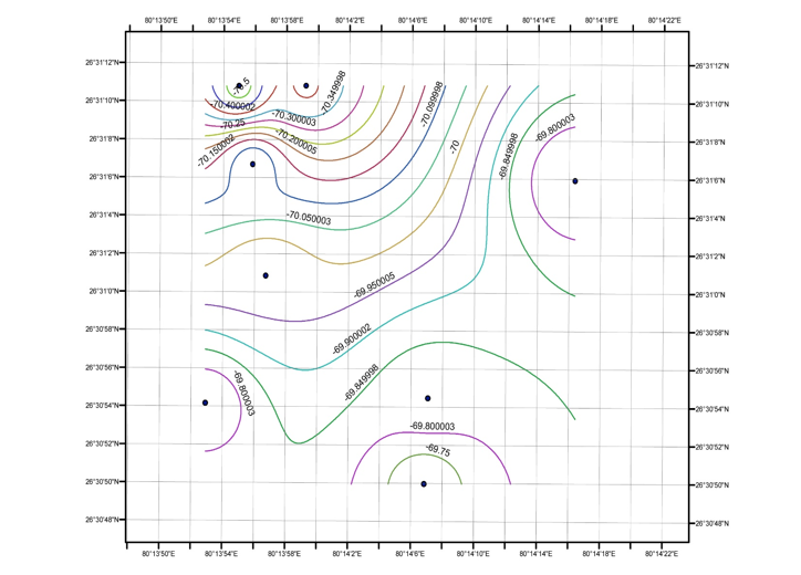
Geoid Model with feature mapping
Geoid model was developed using GNSS and leveling data to estimate spatial distribution. Analyzed data in RINEX file format in Trimble Business Center (TBC).
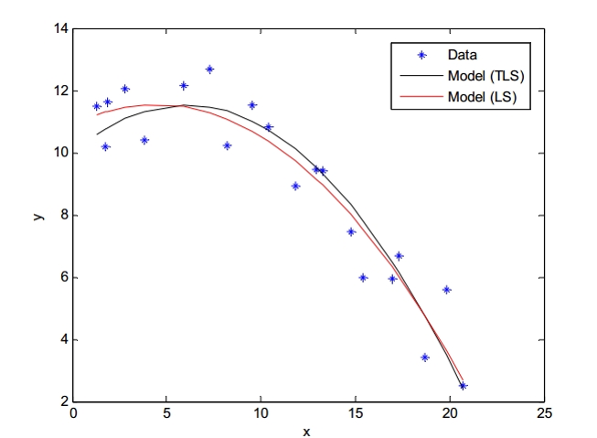
Total least squares
Described various methods of TLS for GPS, Image restoration, information retrieval and astronomy. Performed error analysis and confidence level of results.
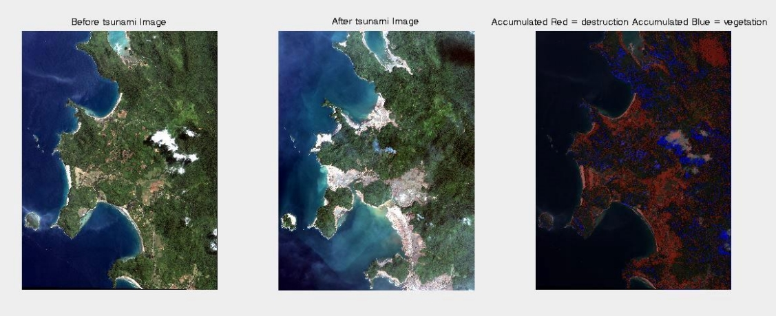
Change detection analysis
Change detection is important to promote better decision making. Various change detection technique is discussed.
Geo-synthetic reinforced soil barrier
Studied geo-synthetic reinforcement properties and concluded that it can be used in construction of slopes as it is better in stability and settlement.
Key Projects
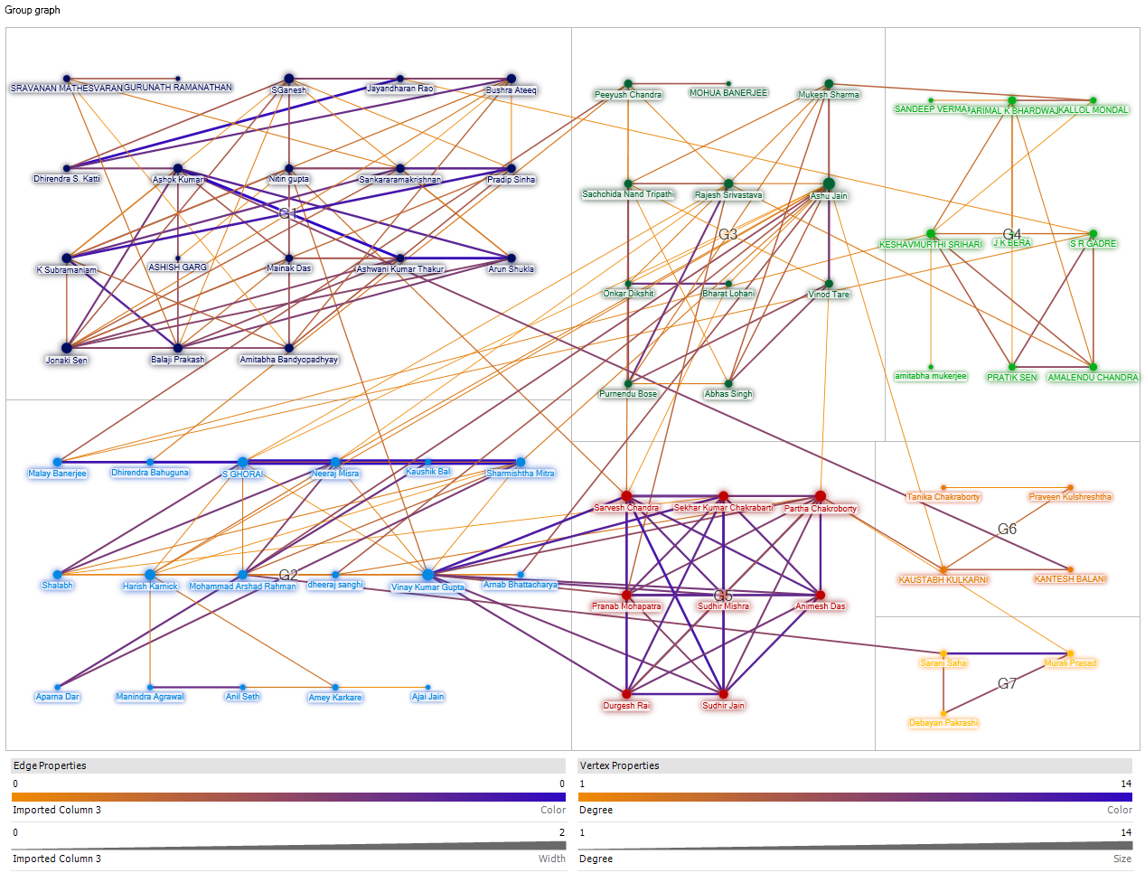
Network Analysis of Research Community
Worked on IIT Kanpur professor’s web pages and research paper to build a multidisciplinary culture of research. Concept used network analysis and social media analytics in Python for file cleaning and data comparison through sliding window technique.
Winter Camp (Survey and Geology camp)
Planned and executed real life mapping problem of Aurobindo ashram at Nainital. Challenge was sloping terrain for that GPS data is adjusted , control was established and multi-date data was aggregated and converted into final map using ArcGIS spatial queries. Observed geology of Nainital area and associated with specific stratigraphic units by Structural Mapping.
2-D projection map
Involved in team project to conduct detailed survey of a part of IIT Kanpur campus. Learned about new instruments like GPS, Total Station and Auto level, survey techniques and softwares by making a map of the area with the observed field points using ArcGIS suite.

Manufacturing
Designed working model of a Drilling Machine and constructed model of a Moon Rover Vehicle. Analyzed work load, identified inefficiencies and modified resulted in production.
Skills Learned
Programming
Python, Matlab
Web Development
HTML5, Javascript, PHP, Mysql
Software
ArcGIS, Trimble business center
Geoinformatics
Surveying, GPS, Total Station, Auto Level
Data Scientist and Algorithms
Image and point data (Laser) analysis
Design
Video Making
Courses Completed
Programming
- Social media analytics
- Fundamental of computing
- Financial engineering
Geoinformatics
- Survey and geology
- Remote sensing
- Laser
- Geospatial data processing
- Geodesy and GNSS
- Machine processing of satellite data
Mathematics
- Linear algebra
- Partial differential equations
- Probability and statistics
- Computational methods
Activities and Participation
- Part of Alumni Contact Program (ACP) in summer 2012 to increase involvement of alumni with institute and managed alumni problems.
- Secured 1st position in intra college Volleyball match (CPA Intramural 2011-2012).
- Spearheaded team of three to secure 3rd position among 15 teams in Star hunt in Takneek.
- Engaged in dance in first year, performed in departmental fresher and dance extravaganza.
- Qualified prelim of programming club challenge Blackbox in 2011.
- Managed personality contest , synchronized activities of team of 10 to drive over 100 users to most sought after title of Mr. and Ms. Antaragini.
- Representative of Society of Civil Engineers - Renewing students and faculties by organizing lecture series by alumni and company officials and assisted events like civil engineering fresher and industrial trips.
- Handled national earthquake design challenge, guided students regarding design and promoted event through various marketing activities leading to increase in participation.
- Professional Assistant for Geographical Information System course - Responsible for conducting labs and tutoring undergraduate in course work of GIS.